Travel Date: August 2020
Written By: Brandy Caitlyn
When it comes to the location “Wesser Bald Firewatch Tower”, I can tell you that it will take your breath away.
The view from this location feels almost unreal as the beauty is that amazing. you feel like you are looking at a painting created that is surrounding you with colors and peaks that you can’t quit reading to touch.
Me and my boyfriend, AP went to my home called the mountains in August of 2020. We were staying at a quaint little cabin in Bryson City North Carolina!
Now anyone that knows me knows, I love nature and love to hike. For the ones that do not know me, it’s true I love it. With all the blogs I post and will continue to post I’m sure you will notice!
When me and my boyfriend set out to do this hike we researched all about it. Now I use the app “AllTrails” that helps guide me and give me the best tips and ways to go!
The app showed a short route of 2.8 miles or a long route of around 8.2. Which one do you think my boyfriend wanted to do??
THE 8.2 MILE TRACK!!!
I will say, this 8.2 mile trip is not for the weak. It was hard. I wanted to quit at times. I encountered incidents I thought I was going to get hurt on. In the end? I had a freaking blast!
Our Trip to The Location!
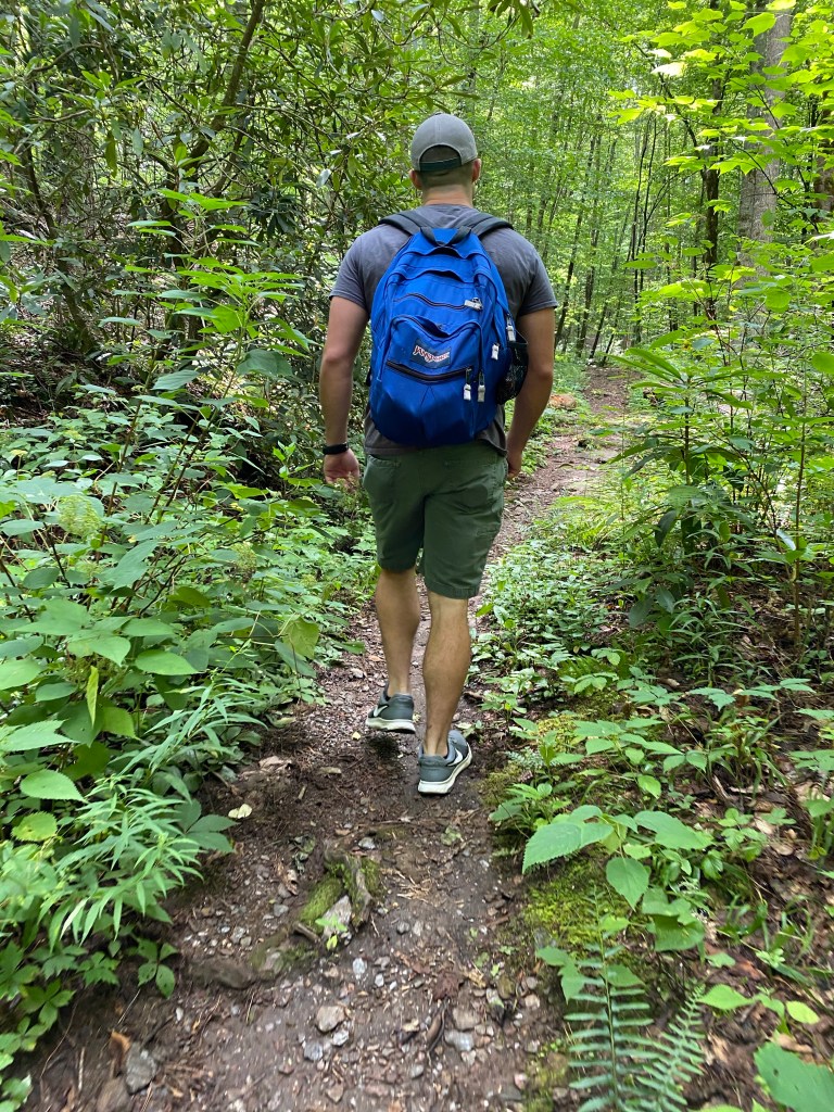
So we got up bright and early the morning we decided to jump into this adventure. We had our backpacks all packed with sandwich’s, snacks and water!
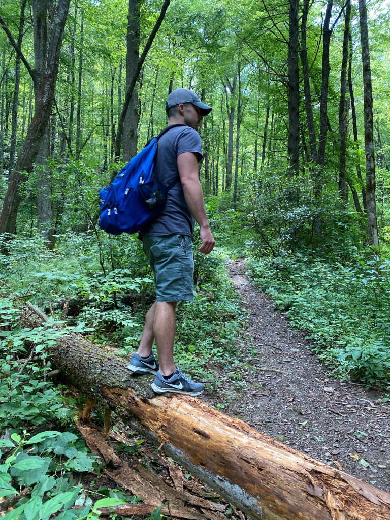
I was wearing shorts, tank top and tennis shoes. He had more appropriate clothing. (You’ll see why I mention this later)
Now this trail you can choose from the long trail and the short trail. when we were heading to the long trail we started going down a residential looking road and came to a steep incline. The incline went up and into an open circular area surrounded by trees.
When we came up the inclined road and looked to the right there was a small path. There wasn’t any marking so we assumed it was the right area and left our car parked in the clearing.
When we started on this adventure the path was wide and we came across an area that looked like someone had been camping in. We continued forward.
The path began to narrow and was going up. Aka up the mountain. When I say narrow, I mean the path was small and some portions it was giving out.
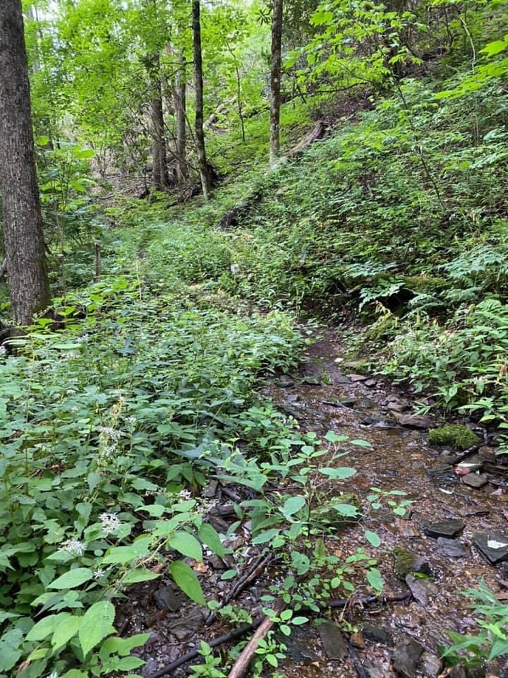
Some parts of the path were overgrown to the point you all the nature was just smacking against your legs.
As we were venturing up the slim path we encountered a snake… when I say encountered I mean AP was walking in front of me and stopped in his tracks… me watching my feet so I don’t fall of the edge (because the plants on our left side were hiding the fact it drops off) I smacked my face right into his backpack.
With confusion it took me a second to realize there was a massive snake in front of us. He takes a stick and nudges the snake to try to get it off of the path. I then try to hustle pass where he was cause… ya girl isn’t trying to get bit
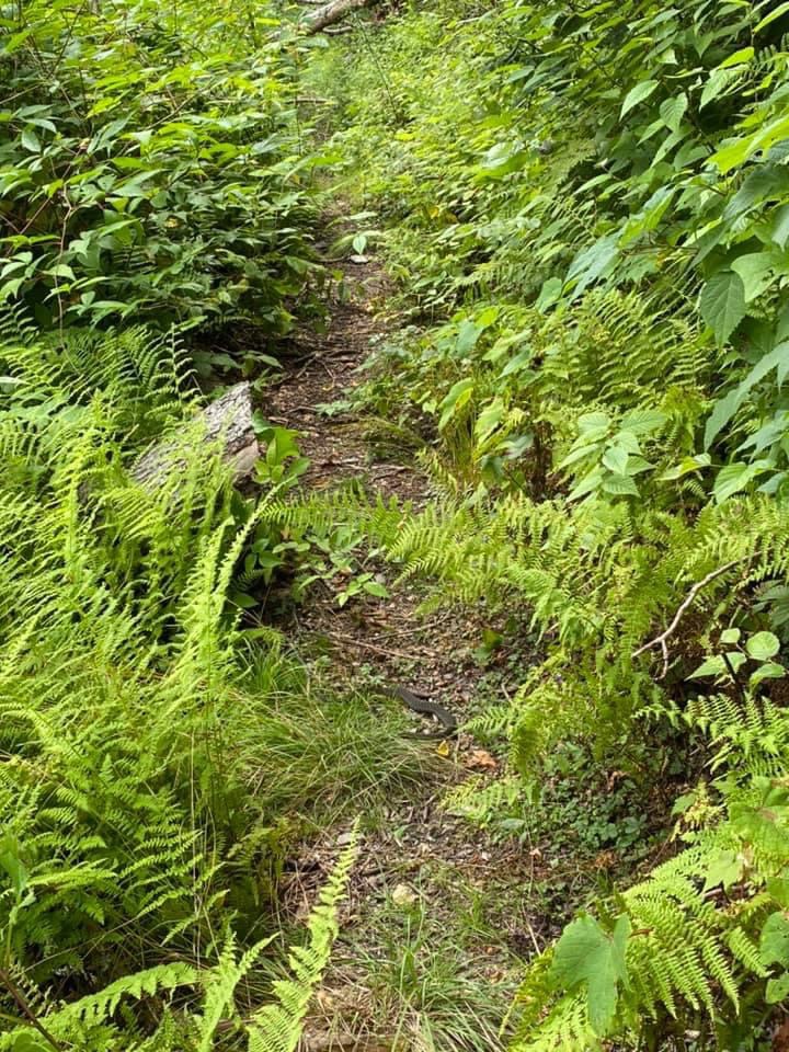
If you look closely at this picture you can see the mighty snake sunbathing. To the left of the snake the mountain drops off.
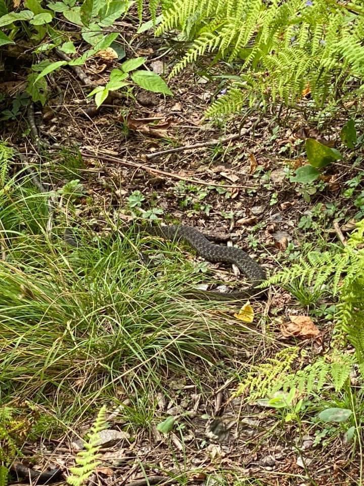
Now I’m not a big fan of snakes… but as long as it stays away from me I am peachy. After we walked past the snake area we continued up the mountain. We came to a clearing that was where we had to continue up the mountain to get to the top.
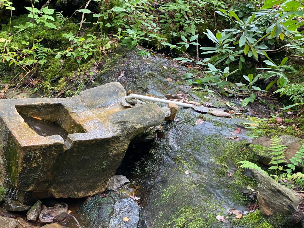
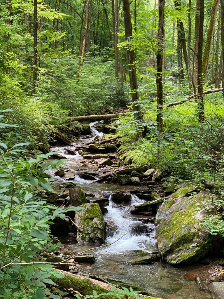
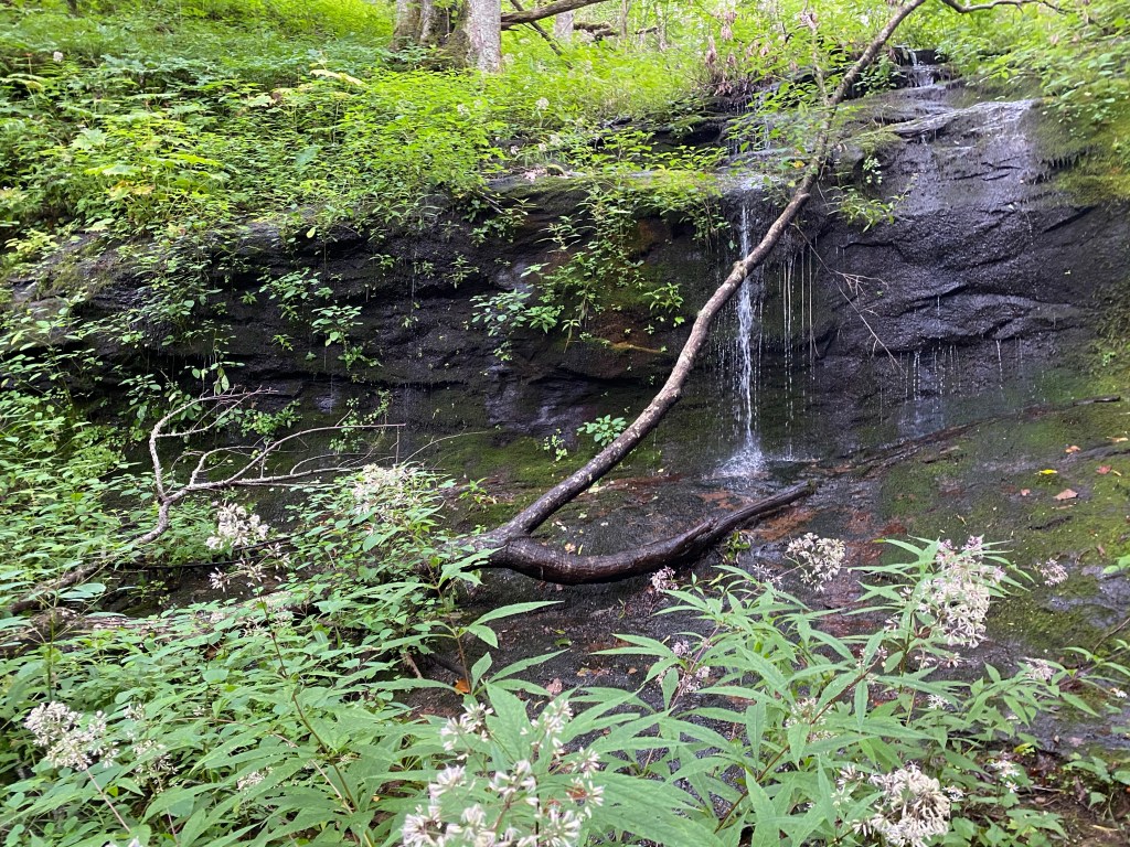
In this clearing we walked past our path that continued up to where we saw a natural -ish spring to fill up on water. Honestly? The water was so cold and refreshing and the design of whoever did this was a genius!
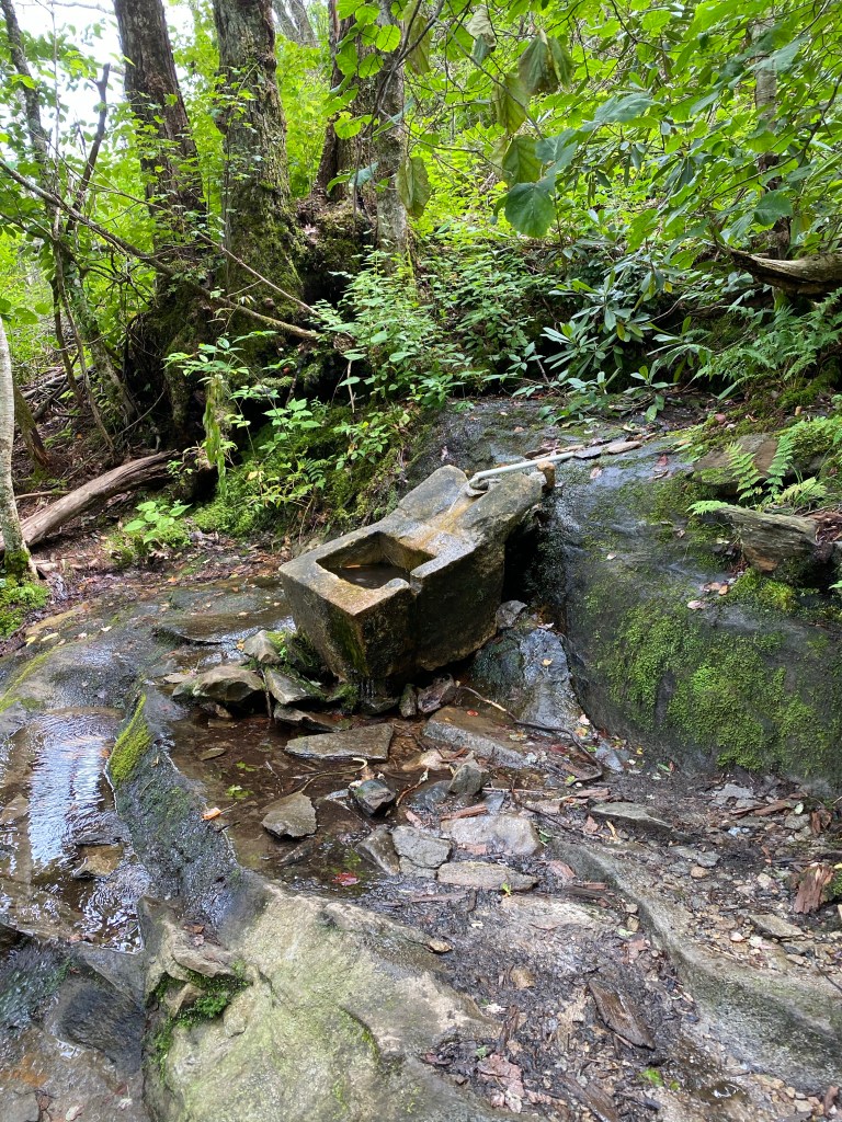
There was a small pipe that connected the water and it runs down for you to place a bottle up too, drink from and that runs into the little concrete block!
After we refilled on water at the coolest thing I’ve ever encountered we kept going up the mountain… this felt more straight up then the rest. It could be that I was scrapped up, exhausted and ready to get to the top.
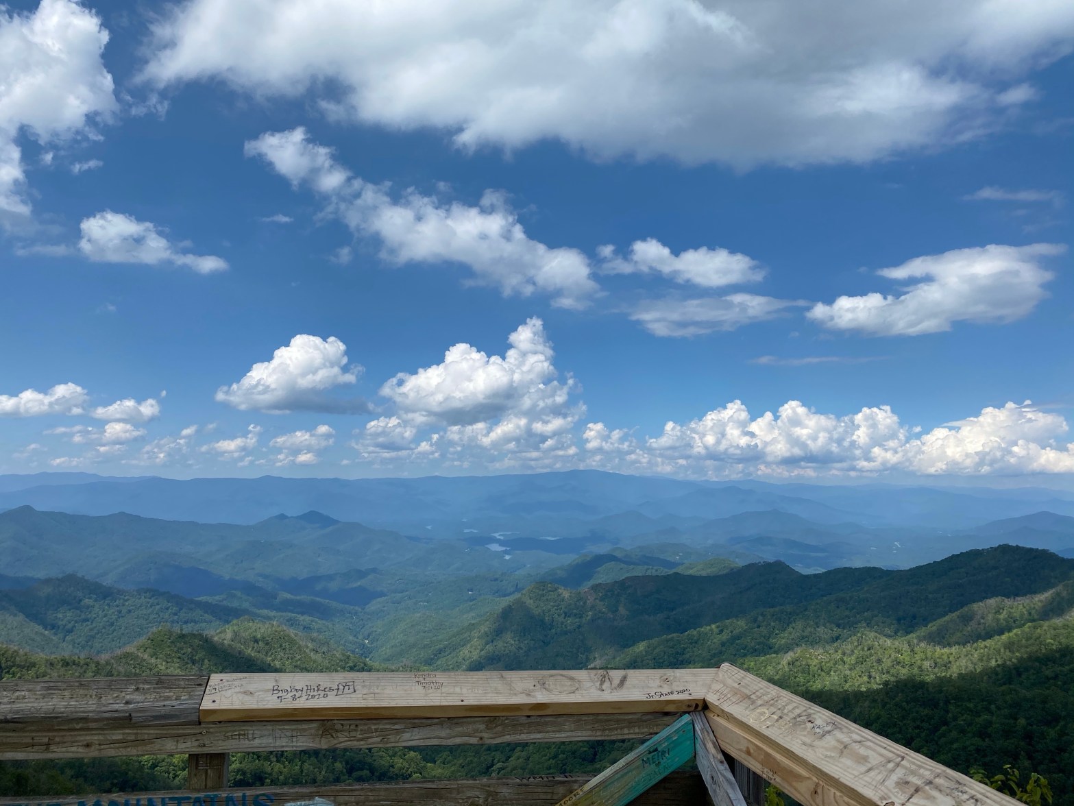
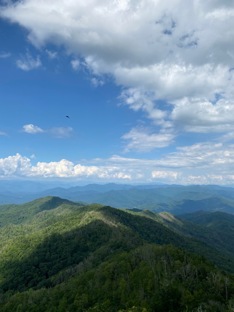
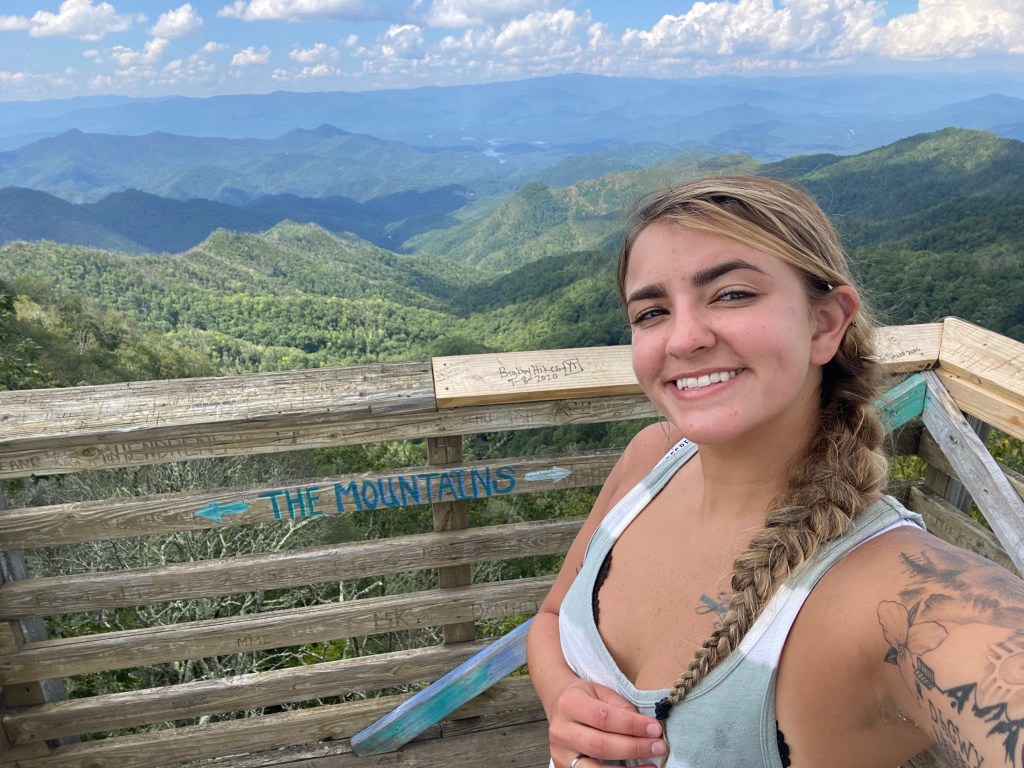
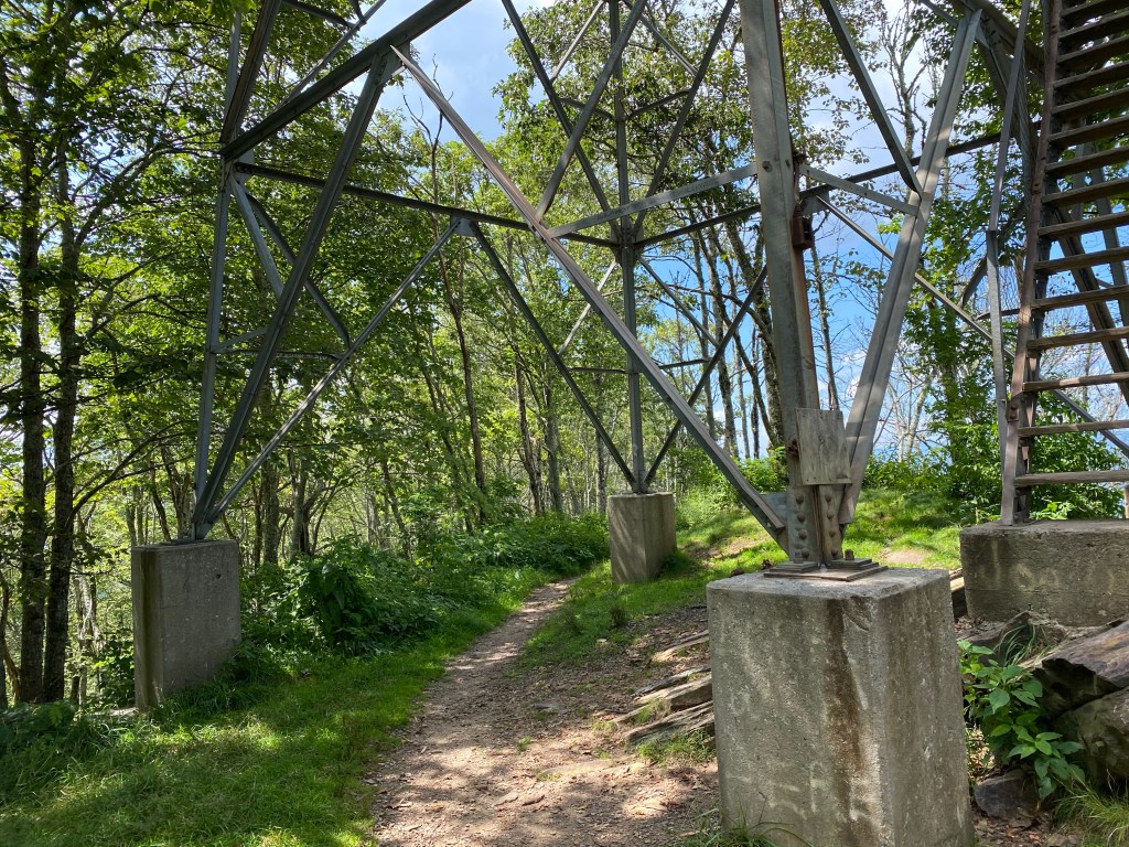
As we are hiking along suddenly AP sees the tower coming into view! It was huge and sitting high in the sky!
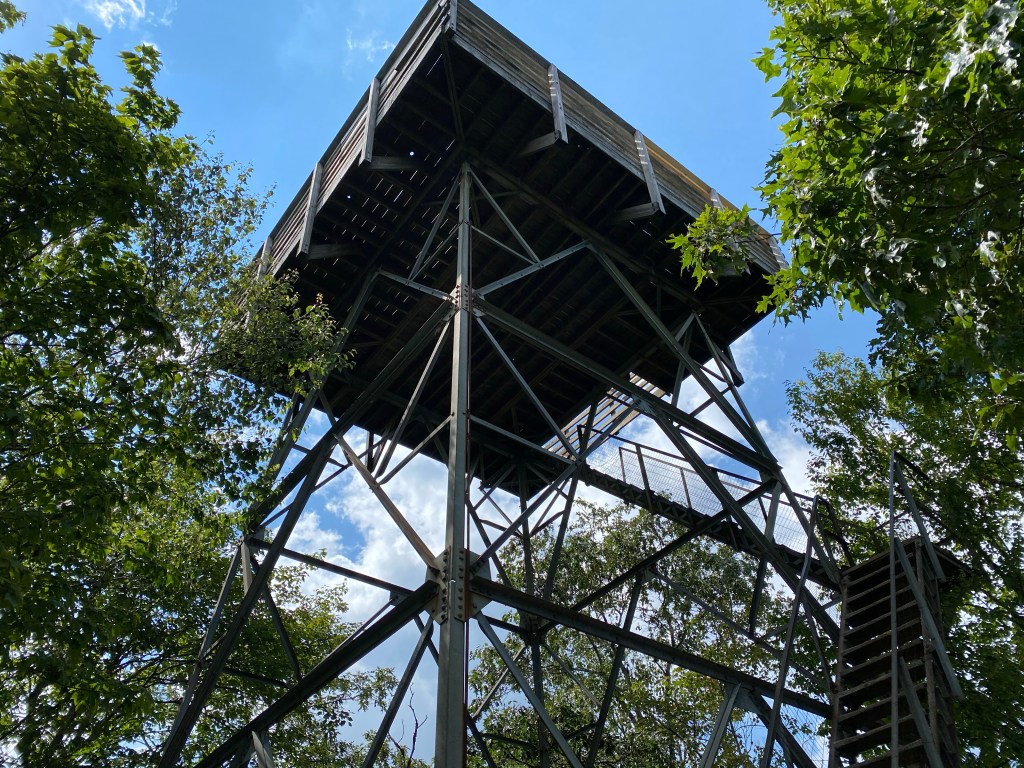
It felt like I had made it to the edge of the rocks after the strenuous hike!
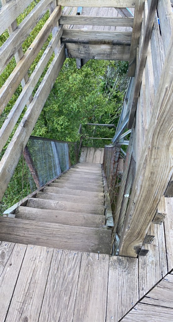
Of course we immediately climbed to the top. My legs felt like jello. The stairs were pretty sturdy.
When we came out on the top, it took my breath away. The view is incredible.
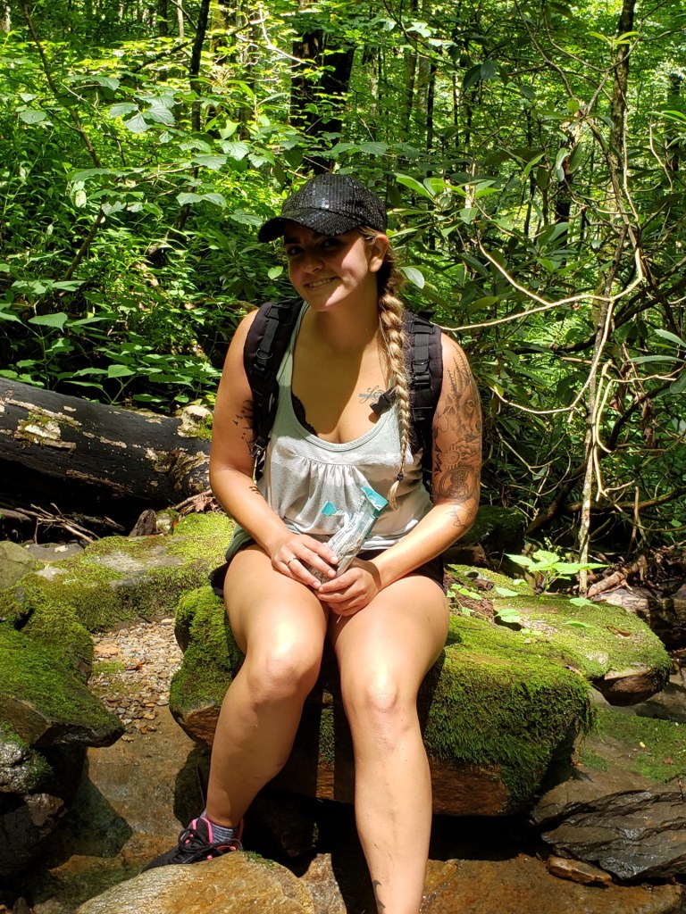
We sat down to rest and fueled back up by eating sandwich’s and snacks! We hydrated and just enjoyed breathing in every bit of nature around us.
- The fresh sky
- The feeling of achievement from hiking up such a big incline and strenuous hike.
- The sky that felt like it extended forever and was just a painting by the one above
- The nature around that say quietly flowing with the slight breeze
After hanging out at the top for awhile and breathing in the amazing views we started our trek back down the mountain.
As we were going down the mountain it was less strenuous but I almost fell not once… but twice…
I was walking calmly along and the next thing I know because of how tiny the path was, my right leg was off the mountain and I was on the ground grasping to not fall the rest of the way.
We kept traveling down, crossing over things, walking through parts of water to get back to our car.
As we neared the bottom we felt like we had just conquered the world… in a way we did.
We hiked 8.2 miles round trip through rough terrain and saw one of the most beautiful views. When we walked out and saw my little jeep sitting waiting it was like a relief but also excitement.
We sat down into the car and just were absoultely exhausted.
But that’s what hiking is all about! Exploring nature, finding new things. Seeing the beautiful creations around us. Going by the moss of the trees and using every muscle inside of your skin.
My Review I Left On AllTrails
So I left this review on a hiking app right after we got done! As a first hand encounter during the year 2020 for others!
“So, sit down and get ready for the review that might help you with this hike immensely!
First! we used directions to get to the spot, but it brought us up to a house and then a path straight up we couldn’t see the top of. We went to the top and there was a circular gravel road. The path is to the right as you come up! I didn’t see many reviews that talked about this and for a second we were confused.
Second, all of the other reviews about a narrow path and overgrown are very true. When we started the hike we thought it was a fib, because in the beginning it was nice and a wide path (there’s is a spot to your left starting that someone has a camp with wood wrapped in plastic this was a marker for us coming back). As we ventured on we soon realized that it was no fib. At some spots it is literally LESS then a foot wide. EXPECT TO FALL ATLEAST TWICE IF NOT MORE. Even with us being extremely careful we still fell. The path is so so so overgrown at the top, to the point that it’s over five feet tall (me) and was hitting me on the head going through.
There are beautiful cascades throughout the hike that are refreshing!
The path is covered by brush and nature in many spots, to the point sometimes you can’t see the path is washed out (sadly it will probably eventually wash completely out in spots). Both me and my boyfriend were walking watching our feet and within seconds were up to our hip with one leg off the mountain side (it’s straight down mostly). It also winds up the mountain constantly.
It is a very beautiful hike but Strenuous as all get out. It was pretty much straight up the ENTIRE time.
We started at 12 and made it to the top around 3-315. We sat up there for around 45 minutes taking in the breath taking views and eating a snack. IT TOOK US AROUND 3 HOURS TO THE TOP (we are both pretty good in shape and we’re moving quickly with barely any stopping). !!!!! THE LAST MILE OR SO WAS THE WORST, even with moving slower it was hard and tons of brush. We headed back around 345pm and got back around 530pm. It took way less time going down then up (but we were moving very fast down). I will say my legs were very sore going down after hiking up and falling.
We came to the top of this trail head and you take a LEFT (also confusing) we had to pull the map out to see which way to go. You will come to another fork in the path (you will see a sign that says water, it has a natural water spring you can drink from). You will then go up to the right from the fork to the top.
The views are AMAZING. The tower is pretty stirdy at the top as long as no ones going up and down the stairs. The stairs were the spot that was a little iffy, but just watch your step most of it was fine.
Also, they made many reviews about trees being down. We did have to cross several trees, but someone has gone through and cut a lot of them in half to make the path clear!!!!
WEAR LONG PANTS AND SLEEVES, there are tons of briars and poison (all kinds). Fall would probably be the best time to do where some of the stuff is not as full.
Lastly, do the hike. Experience it. And leave nothing but foot prints behind”
More pictures!
Pictures from traveling up the mountain!
The top and destination area!

There Is Nothing Better Than To Hike and Travel.
Here is to more hard hikes.
As always, respect the earth. Respect nature and #LeaveNoTracesBehind
Much love, B.
References
Wesser Creek Trail on AllTrails
https://www.alltrails.com/trail/us/north-carolina/wesser-creek-trail
